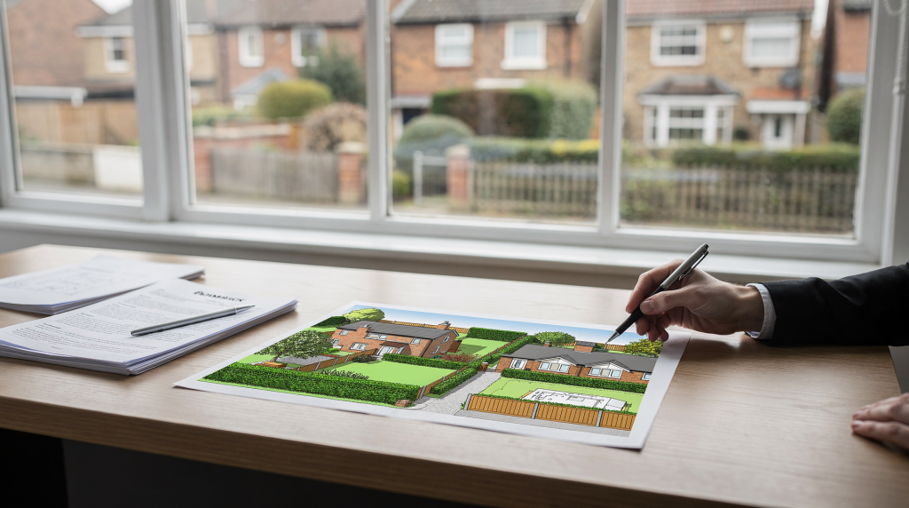
Most homeowners assume their title plan marks the exact edge of their land. In reality, the red line on a Land Registry plan is only a general indication. To understand what you actually own, you need to piece together the title register, any historic deeds, and the physical boundaries on the ground. Getting this right early can save you from expensive disputes, delays when selling, or the shock of discovering you’ve built an extension on land that isn’t yours.
What a property boundary actually is
A legal boundary is the invisible line that separates one owner’s land from another’s. It has no width of its own. A physical boundary is what you see on the ground: a fence, wall, hedge, ditch, or stream. The two don’t always align neatly. I’ve seen cases where a fence was built a foot inside the legal boundary simply because the original owner found it easier to erect it there. Years later, the current owners were surprised to learn they didn’t own the strip of land up to the fence. The legal line can run through the middle of a hedge, along one side of a wall, or somewhere nearby depending on what the deeds say and how the land has been used historically.
How title plans work in England
HM Land Registry title plans are based on Ordnance Survey mapping, usually at a scale of 1:1250 or 1:2500. The red edging shows the general extent of the registered land, but it’s not designed to pinpoint the exact boundary. The thickness of the red line alone can represent a metre or more on the ground. Small shifts can also occur because the plan is tied to mapping data, not a physical survey. This means the plan may follow a fence or hedge on the map, but that doesn’t prove you own the feature itself. When I’m helping a client buy a property, I always advise them to walk the site with the title plan and any old deeds, comparing what’s on paper with what’s actually there. Relying on the plan alone is a recipe for misunderstanding.
Deeds vs title plan: which matters more?
Older properties often come with paper deeds—conveyances, transfers, or old plans—that can be far more revealing than the modern title plan. The original conveyance (the root deed) may contain specific measurements, reference points, or wording like “along the centre of the hedge” or “to the outer face of the wall.” In a boundary dispute, that historic language usually carries more weight than the red line on a Land Registry plan. The title plan shows the registered extent, and the title register may refer to filed documents, but the deeds often hold the best evidence of where the boundary was first drawn. If the deeds and the title plan appear to conflict, the wording and the historical context matter more than assumptions based on where a fence now stands. Always check both sets of documents—and if the deeds are missing, ask whether copies were filed at the Land Registry.
What HM Land Registry records — and what it does not
For most properties in England and Wales, there is no official record of the exact boundary line or of who owns the boundary features—the hedge, wall, tree, or fence. The title plan gives you a general location, but it usually won’t resolve exact ownership. That’s why two neighbours can both feel certain they’re right and still both be wrong if they’re relying only on a visible fence line or the red edging on a plan. Occasionally, the title register includes “T” marks that indicate responsibility for maintaining a boundary feature, but these are not always present and don’t necessarily define ownership. The register is a record of title, not a detailed boundary survey.
Common signs that a boundary needs closer checking
You should review the documents carefully if any of the following apply:
- a neighbour says the fence is on their land
- you want to replace or move a boundary structure
- you’re planning an extension near the edge of the plot
- a sale is delayed because the buyer raises a boundary query
- the physical boundary doesn’t match the title plan
- the deeds mention measurements, offsets, or fixed features that are no longer there
These are the situations where a quick glance at the title plan is almost never enough. Ignoring them can lead to a trespass claim or a stalled conveyancing transaction.
Step-by-step: how to check a boundary properly
- Get the official title plan and title register for both properties if possible—sometimes the neighbour’s documents contain the most useful description.
- Read any filed deeds or historic conveyances that mention the boundary. Look for measurements, compass bearings, or references to physical features.
- Compare the documents with the actual features on the ground, including fences, hedges, walls, and ditches. Take photos and notes.
- Look for phrases like “along,” “to,” or “by reference to” a specific feature. Old measurements in feet or links can be converted and checked on site.
- If the documents are unclear or the physical layout has changed, instruct a chartered land surveyor experienced in boundary work to assess the site.
- If the issue remains unresolved, discuss it early with the neighbour before starting any work or making accusations. A calm, evidence-based conversation often prevents a full-blown dispute.
When a surveyor helps
A chartered land surveyor becomes valuable when the paperwork doesn’t give a clear answer, or when the land has been altered over time. A survey can overlay old maps onto modern GPS data, identify where original boundary markers might have been, and provide a measured opinion on the likely legal line. This is especially helpful where the boundary is long and irregular, the land has been landscaped, or old plans lack detail. A surveyor’s report doesn’t automatically decide legal ownership—that remains a matter of law—but it provides strong evidence that can make negotiation far easier and carry weight if the matter ever reaches court.
General boundaries and determined boundaries
Most registered titles operate under the general boundary rule, meaning the exact line is not fixed by the title plan. In a limited number of cases, a landowner can apply to the Land Registry for a determined boundary—a formal process that fixes the precise line. This isn’t a casual administrative update. It requires detailed evidence, precise plans, and often leads to objections from neighbours. The process is expensive and time-consuming. For most people, a better route is to agree the boundary informally with the neighbour and record the agreement in writing, possibly registering it as a boundary agreement. Determined boundaries are best reserved for situations where absolute certainty is genuinely needed, such as before a major development.
Typical boundary features and common assumptions
Some everyday assumptions about boundaries are often wrong. A fence is not automatically the legal boundary; it may have been erected for convenience well inside the true line. A hedge is not automatically owned by one side—it could be a party hedge. A ditch doesn’t always mean the boundary sits on the opposite bank; the “hedge and ditch” presumption is just a starting point, not a fixed rule. A wall built by one owner isn’t necessarily the limit of their land. The only safe way to work out ownership is to combine the documents, the physical evidence, and any relevant history of use and maintenance.
Boundary disputes: what to do first
If a disagreement starts, resist the urge to remove or alter the boundary feature before the position is investigated. Start with the paperwork, then share information with the neighbour where possible. A practical approach is:
- stay calm and focus on evidence, not emotion
- collect title documents, deeds, and old photographs
- compare both properties’ plans side by side
- avoid moving fences, hedges, or walls until the facts are clearer
- instruct a surveyor if the documents aren’t decisive
Most disputes become harder—and more expensive—once one side has altered the boundary feature before agreement is reached. Courts take a dim view of self-help, and the costs of litigation can quickly dwarf the value of the disputed strip of land. Early dialogue and joint expert input are nearly always the wiser path.
Checklist: documents to gather
- Title register
- Title plan
- Old transfer or conveyance deeds
- Historic plans attached to the deeds
- Mortgage survey or recent survey report
- Old photographs of the boundary
- Planning drawings if the land has been developed
- Any written agreement between neighbours
Table: what each document can and cannot do
To help you weigh up the evidence, here’s a quick comparison of the main documents and their limitations.
| Document | What it helps with | Main limitation |
|---|---|---|
| Title plan | Gives a broad outline of the registered land | The red line is only a guide; it doesn’t pinpoint the legal boundary |
| Title register | Records ownership and may reference filed documents | Rarely describes the precise boundary line |
| Old deeds | May contain original measurements or descriptions | Can be outdated, ambiguous, or inconsistent with the site |
| Surveyor’s report | Interprets the physical site alongside the documents | Provides an expert opinion, not a legal determination of ownership |
Selling or buying a property with a boundary issue
If you’re buying, raise any boundary uncertainty early in the conveyancing process. The standard Property Information Form (TA6) asks the seller about boundary features and disputes, but the answers are only as good as the seller’s knowledge. I always recommend that buyers submit specific pre-contract enquiries about any boundary that looks unclear, and if possible, walk the site with the seller or agent to understand the history. Lenders may refuse to lend if the boundary is seriously in doubt, because it affects the security value. If you’re selling, disclose known issues honestly and provide all the paperwork you have. Boundary problems ignored before exchange of contracts can resurface after completion as a costly dispute or a claim for misrepresentation. In some cases, a special condition can be inserted into the contract to deal with the uncertainty—for example, requiring the seller to resolve the matter before completion or to retain part of the purchase price until it’s settled. The safest approach is to tackle the issue head-on before exchange.
Key points to remember
- The title plan usually shows general, not exact, boundaries.
- The red line is a guide, not a survey measurement.
- Deeds and old conveyances can matter more than the map when the boundary is unclear.
- There is usually no official record of the exact line or of ownership of boundary features.
- A surveyor can help, but a survey alone does not automatically decide legal ownership.
- Determined boundaries are possible, but they are more formal and evidence-heavy than a normal title review.
FAQ
Does the red line on a title plan show the exact boundary?
No. It usually shows the general extent of the land, not the precise legal boundary. The thickness of the line and the scale of the mapping mean it can only ever be an approximate guide.
Who owns the fence, hedge, or wall?
There is no central database that records ownership of boundary features. You need to check the deeds for any “T” marks, covenants, or historic descriptions, and look at who has maintained the feature over time. Even then, the answer can be ambiguous, and it’s often a matter of evidence rather than a clear rule.
Can a title plan override old deeds?
Not necessarily. Old deeds and filed documents often carry more weight when interpreting the true boundary position, especially if they contain specific measurements or descriptions that the title plan lacks.
Should I use a surveyor in every boundary issue?
Not always. For simple matters where the documents are clear and both neighbours agree, a surveyor may be unnecessary. But for unclear or disputed boundaries, a surveyor’s report is often the most practical way to narrow down the likely line and provide a basis for negotiation.
Can a boundary be officially fixed?
Yes, in some cases a determined boundary application can be made to the Land Registry, but it’s a formal, evidence-heavy process that may face objections. A less confrontational alternative is a written boundary agreement with your neighbour, which can be lodged with the registry.
Conclusion
Property boundaries in England are more about piecing together evidence than finding a single definitive answer. The title plan is a starting point, not the final word. The real position usually depends on the register, the deeds, the physical features on the ground, and any historic use. If there’s any doubt, check the paperwork early, talk to your neighbour, and get expert help before a minor uncertainty turns into a major dispute. A few hours of careful investigation now can save you a great deal of time, money, and stress later.